A Satellite View of the Past
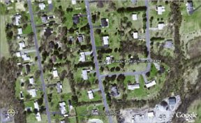
Want to kill precious hours in your day? I got off-track today playing with Google Earth. I decided to grab a pic of the street where I grew up in New Jersey. I haven't been back there in over 15 years so I started moving the map around to all the places I used to spend my time as a young person. New Jersey was much more rural when I was growing up...but our street is pretty much what it was...the surrounding area is what used to just be fields and trees and now is all housing developments, but I was still fascinated by how things look now, at least from the perspective of some satellite passing overhead.

The map wasn't too bad. The "square" for the GPS was just two houses off (my old house is actually two house above where the square with the address is on the map). Every house on the block has all kinds of stories attached to them, for who lived there at the time. You can look at a larger image of this same map here.
Then look up your friends...other family members (I really liked switching from an address in California to one in New Jersey - the satellite actually scans across the entire U.S. to refocus its view...very cool), then start picking exotic locales...you may never have to start to paint!
Technorati tags: maps , earth , New Jersey
posted by KatieMoe at 10:17 AM
![]()
0 Comments:
Post a Comment
<< Home